Introduction
In this topic we’ll:
- describe how cultural and historical considerations may factor into your design
- introduce a number of legal considerations you need to be aware of when undertaking landscape design and construction work.
By the end of this topic you’ll be able to:
- Identify reasons why it is important to understand the history of the region you’re working in.
- Identify key legal requirements related to landscape construction which may influence your landscape designs.
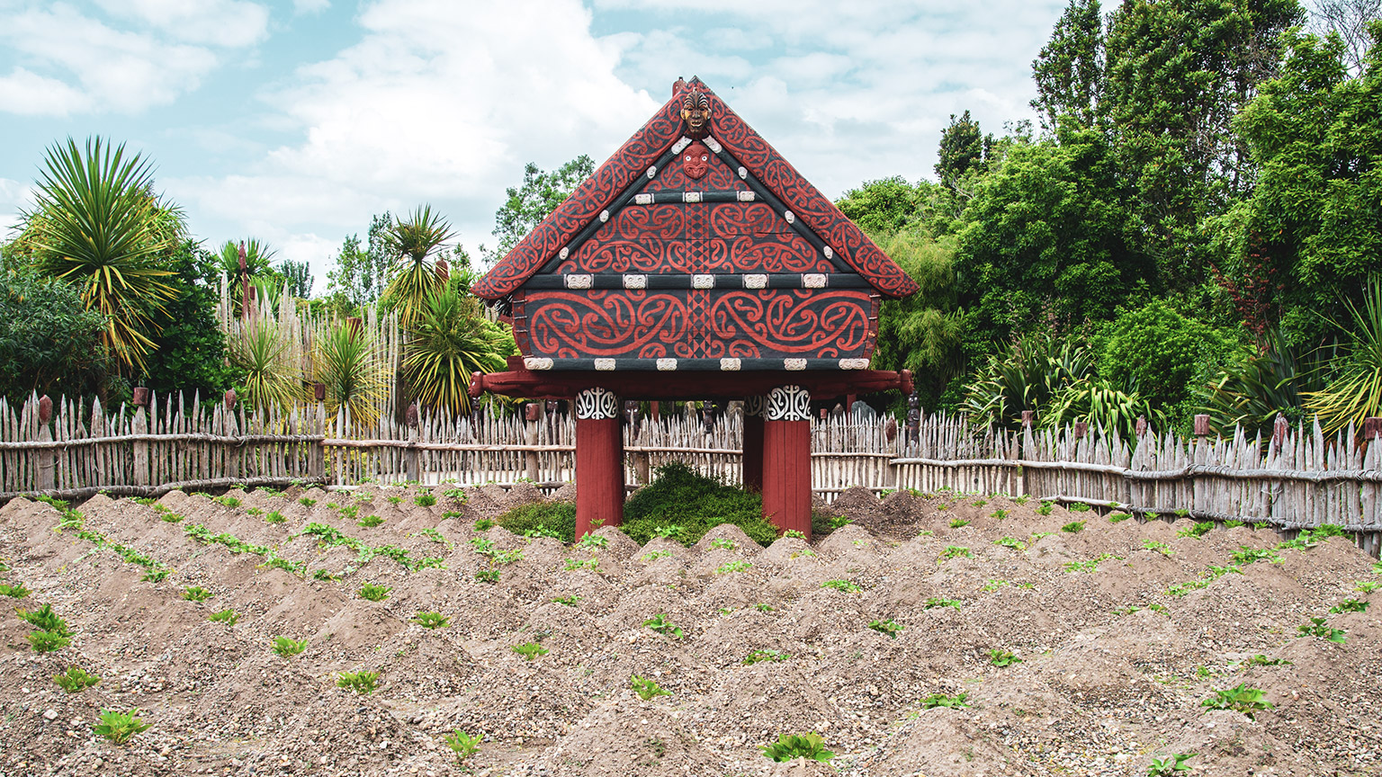
When working with the land, as is the case with landscaping, it’s a good idea to get to know the history of the area: the land and the people who have come before.
Not only will this help you feel more connected to this place, but it may also come in handy when you’re designing gardens. Well-designed gardens connect to the surrounding landscape, for instance:
- using plants that grew naturally in the area before Pakeha settlement
- opening up views to nearby landforms, significant to tangata whenua, like maunga (mountains), awa (rivers), and ngahere (forests) or historic pa sites
- orientating design features towards culturally or historically significant sites.
Having a good sense of the history of the area may also help when discussing design options with clients. By offering suggestions, like those above, you show your professionalism in working with the whenua (land).
Another cultural consideration is that of your client. When you met with them you may have asked, or they may have offered information, about their own cultural background and whether that has any implications for how they would like their garden designed. If they have explicitly stated that they want their culture brought into the garden design, do some research to better understand that culture’s methods and traditions and how they can be incorporated into your plan.
Explore
Research the pre-European and post-European history of the area your site is in. Try to find information about both the plants that grew in the region, any significant historical events and places of significance.
Share your findings in the area Pre-European and Post-European History of New Zealand forum thread.
Compare your area to the areas your classmates researched and posted about. What is similar or different to your area?
You might like to start by using the following online resources:
Legal boundaries
Only design and construct landscape features on sites for which you have the owner’s permission. By engaging you to design their garden, it is implied that they are the owner of the property, but if in doubt, ask.
Use your best endeavours to confirm the legal boundaries of the site. This way you won’t end up working on areas that turn out to belong to the neighbours.
If possible, ask the client to provide you with a copy of the survey plan – this is sometimes attached to the Certificate of Title (CT) – or construction drawings if the property is relatively new. These documents should include information about the boundaries, including their bearing (angle from north) and length. Make sure you read the correct units off the plan, as old survey plans may be in feet and inches rather than metres.
Having a survey plan can be helpful when it comes time to draw up your base plan, but it can be hard to work out how these boundaries relate to objects in the real world. If possible, find the survey pegs when you go to the site to measure up.
Reading
This webpage by Stratum Consultants provides a good summary of the three most common types of survey boundary markers used in Aotearoa. Read the summary and complete the task that follows.
Stratum Consultants - How to Identify your Property Boundary
Check your property or the property of your client: if you were able to locate the boundary markers, which type were used?
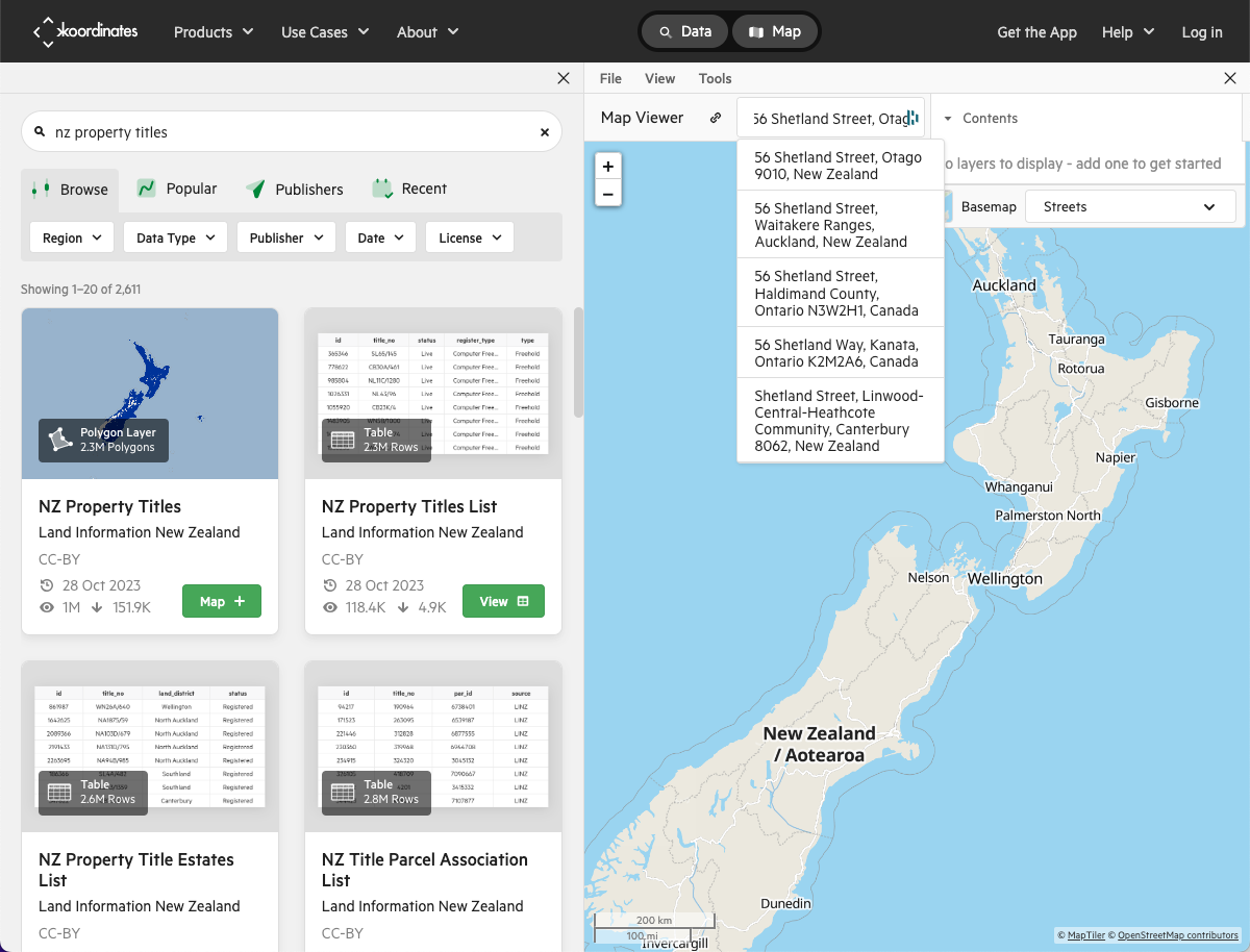
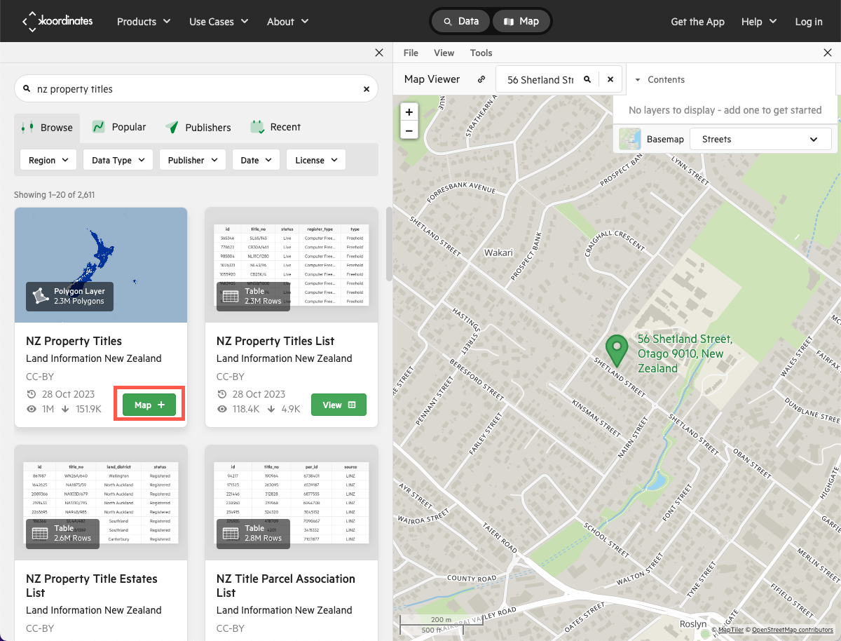
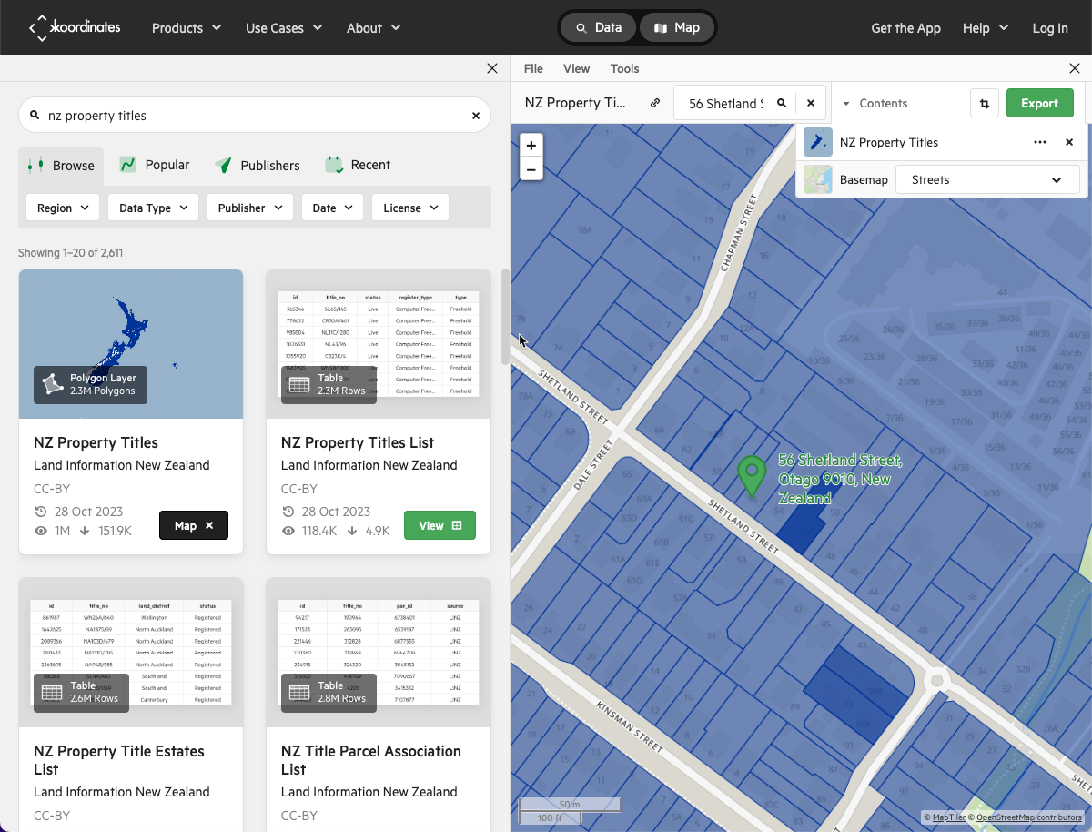
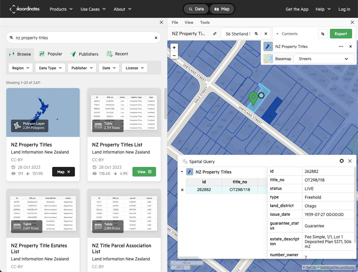
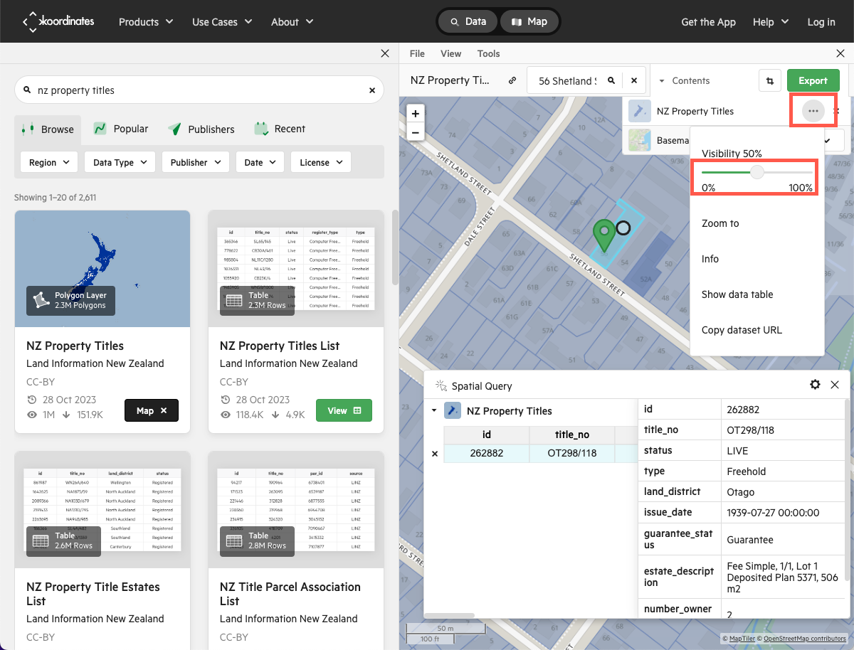
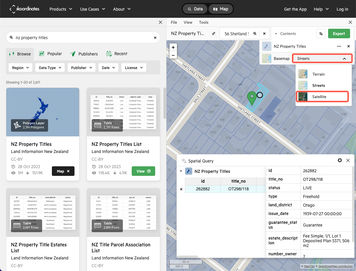
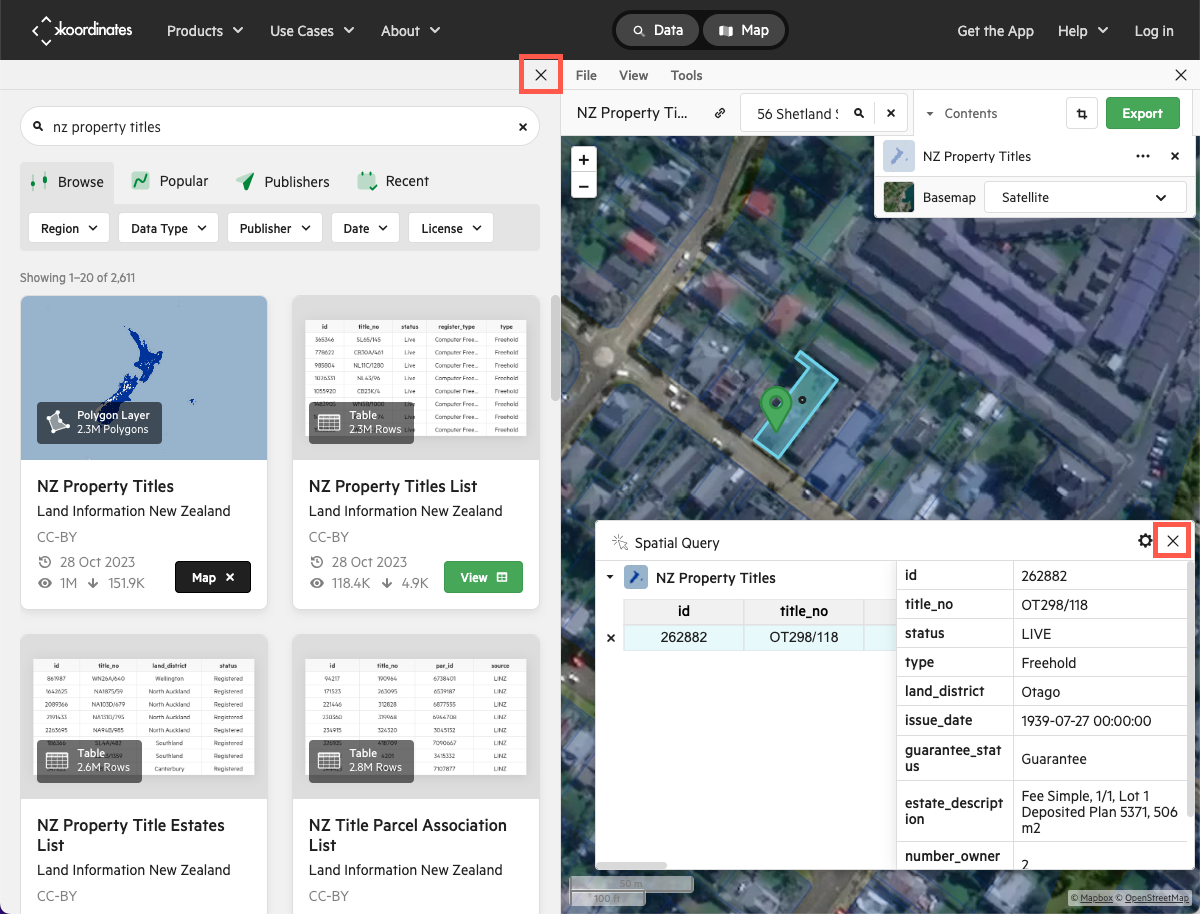
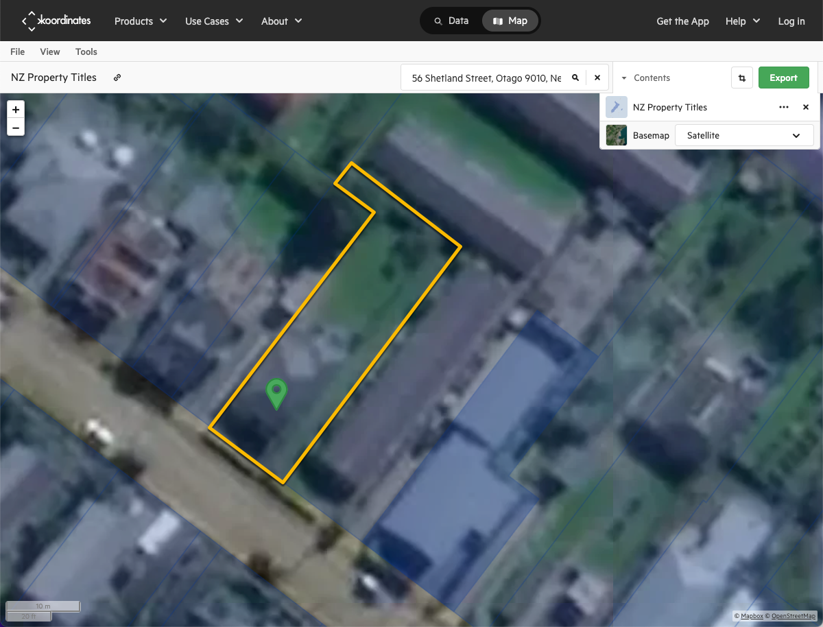
Using Koordinates to visualise property boundaries
You might find it helpful to see the property boundaries overlaid onto an aerial image of the area. You can do this by using the Koordinates website.
Click on each heading below to display instructions for using Koordinates.

Protected trees
Trees are a valuable addition to any garden. They extract carbon dioxide from the air and provide habitat for animals. Carefully consider if any existing trees can be factored into your design and try to remove as few as possible. If you decide a tree does need to be removed, first check that it is not a protected tree.
Some trees are protected under law. This means that to remove, or in some cases even prune them, you will need to get consent from the council. If you want to check if any trees on the property you are designing on fall under this category, visit the relevant council’s website or give them a call. You may encounter the terms ‘notable,’ ‘’heritage’ and/or ‘protected.’
For example, Auckland Council talks about notable trees in its Unitary Plan. Take a look at Auckland Unitary Plan Schedule 10: Notable Trees.
Alternatively you can use the Unitary Plan GIS Viewer and type in the property address then see if anything is listed in the Results tab.
If you are interested in knowing more about how a tree is deemed ‘notable,’ read page four of this document. This is the criteria used by Horowhenua District Council; other councils may use a different system: Horowhenua District Plan Schedule 3: Notable Trees
Explore
Search your local and regional council’s websites for a notable tree list. Check the address of the site you’re designing to see if there are any notable trees.
You might like to bookmark these resources to refer to later.
Boundary rules
It is common for councils to specify boundary rules. A boundary rule is “a rule in a District Plan relating to the distance between a structure and a property boundary (or boundaries), or the dimensions of a structure in relation to its distance from a boundary” (Ref: Ministry for the Environment, 2017). The boundary area that cannot be built within (without consent) is often referred to as a setback.
It is possible to build within this area but there are some hoops to jump through so if at all possible avoid placing structures within the setback. In some cases it may be unavoidable, in which case the client might need to apply for “permitted boundary activity notice”, as described in this report by the Ministry for the Environment.
Explore
Search your local and regional council’s district plan for boundary rules. Some councils have different rules for different suburbs or ‘special character areas.’ Check the rules to see what setbacks apply to the site you’re designing.
Again, you might find it useful to bookmark these resources to refer to later.
Pool fencing requirements
According to clause F9 of the Building Code Regulations, all pools that have a maximum water level of 400mm or more must be fenced in such a way that they prevent access to the pool by a child under 5 years of age.
The key points are:
- Spa pools either need to be fenced or have a lockable cover.
- Pools need a fence, typically 1.2m high, that can’t be climbed.
- There must be nothing on the outside of the fence that would allow a child to climb over it.
You can read more here: Clause F9—Means of restricting access to residential pools
Retaining walls
Retaining walls are outside the scope of this course anyway, but it is worth noting that retaining walls over 1.5m tall require building consent. Retaining walls lower than 1.5m are exempt provided they are constructed in accordance with exemption 13.2 Retaining walls up to 1.5 metres depth of ground.
Activity
Have a go at answering the following questions. Be sure to review the information in the topic before moving to the next one.
Summary
Pai ki a koe!
We’ve reached the end of this topic on site considerations. By now you should be able to:
- Identify reasons why it is important to understand the history of the region you’re working in.
- Identify key legal requirements related to landscape construction which may influence your landscape designs.