In the previous topic, we looked at a few ways to classify soil based on its properties, such as texture and pH. These are some ways of thinking about soil, but another is to talk about soils in terms of the way they were formed. That’s what this topic is about.
We’ll introduce the New Zealand Soil Classification and talk about how this relates to the soil profiles we see when we dig a test pit.
Different soils exist because they have formed through different processes. Equally, soils keep developing — they never reach an end state.
Activity – Soil formation knowledge check
Read the following page on the Manaaki Whenua Landcare Research’s Soils Portal website called How do soils form?
This gives a good overview of the basic process of soil formation.
After you have read it, answer these eight questions to check your understanding.
In Māori culture, the importance of soil can be seen by the language. There are at least 60 names for different types of soil, including:
- One-pū – sand
- Kere whenua – yellow clay
- Onetakataka – a friable soil
- Rei – Peat
- Pungapunga (also purupuru) – pumice soils.
Find out more here at Landcare Research NZ.
As mentioned previously, where different soils formation processes occur – such as chemical processes of clay formation or freezing and thawing cycles – different types of soils will form.
![[ADD IMAGE'S ALT TEXT]](/sites/default/files/NZ_soil_map.jpg)
In Aotearoa, we create order out of this wide variation by a classifying (sorting) system called the New Zealand Soil Classification (NZSC). The NZSC is a hierarchy similar to the botanical taxonomies we learned about earlier. And like our botanical taxonomy, soils are classified according to how they formed and their physical characteristics.
At the highest level, there are 15 soil orders. The following table shows soil orders based on their age.
| Age | Key soil-forming factors | Soil order |
|---|---|---|
| Young soils | Raw Soils | |
| Recent Soils | ||
| Anthropic Soils | ||
| Mature soils Soils that have well developed topsoil and subsoil horizons |
Climate Soils formed in quartz rich material that show the effects of climate |
Semiarid Soils |
| Pallic Soils | ||
| Brown Soils | ||
| Podzols | ||
| Wetness Soils with prolonged high-water tables |
Gley Soils | |
| Organic Soils | ||
| Rock soil parent materials formed from rocks that dominate the soil character, e.g., limestone, basalt, pumice and volcanic ash |
Melanic Soils | |
| Pumice Soils | ||
| Allophanic Soils | ||
| Old soils On land surfaces with parent materials that have attributes of advance weathering |
Ultic Soils | |
| Granular Soils | ||
| Oxidic Soils |

In the hierarchy, beneath the soil order are soil groups, subgroups, families, and siblings, each being more specific than the last.
Activity – Soil map viewer
Manaaki Whenua provides a range of interactive maps that contain scientific information about soils and land use. The Soils Map Viewer contains some of that data, in an easy-to-use form.
Go to this site now and find the NZSC soil order for an area you are familiar with. To do this:
- Click here, allow the site to know your location and then click the ‘Proceed to site…’ button.
- Read the tips that appear and then click the ‘Ok’ button.
- Use the + and - buttons at the top left (or use your mouse scroll wheel) to zoom in. Click and hold your left mouse button down and then drag the mouse to move the map around. Zoom in to an area of the map that you’re familiar with.
- Use the slider at the bottom left to make the data layer more transparent so you can see the map layer beneath it. When you’ve found the location that you want to investigate, click on it on the map.
- A box will appear with a classification code in it. In the key, at the top right, use the < and > arrow buttons to cycle through the soil orders and groups.
- The text above the coloured boxes is the name of the soil order. In the image below, the group is Sandy Brown, and the soil order is Brown Soils.
- Click the labels or the (+) below to open a description of each soil order.
![[ADD IMAGE'S ALT TEXT]](/sites/default/files/Soil%20Map%20Viewer.png)
Click the (+) sign or the soil name to view descriptions of the 15 soil orders according to Soil orders of New Zealand (Maps).
Allophanic Soils are dominated by allophane, (and also imogolite or ferrihydrite) minerals. These stiff-jelly-like minerals coat the sand and silt grains and maintain a very porous, low-density structure with weak strength. The soils are identified by a distinctly greasy feel when moistened and rubbed firmly between the fingers. The soil is easy to dig and samples crumble very easily when crushed in the hand. When moist the topsoil is usually very dark brown or black and the subsoil is usually yellow-brown.
Allophanic soils occur dominantly in North Island volcanic ash, and in the weathering products of other volcanic rocks. They also occur in the weathering products of greywacke in the South Island high country.
Anthropic Soils are soils constructed by, or drastically disturbed by people.
They include soil materials exposed by stripping of the natural soil, deposition of refuse or spoil, or by severe soil mixing. The original character of the soil is lost, and the soil properties used to identify other soils are lost.
Anthropic Soils are most extensive in urban areas and areas that have been mined.
Brown Soils have a brown or yellow-brown subsoil below a dark grey-brown topsoil. The brown colour is due to thin coatings of iron oxides which have weathered from the parent material.
The majority of Brown Soils occur in places in which summer dryness is uncommon and which are not waterlogged in winter. The precipitation is usually more than 1000 mm per year although it may be less in some stony soils.
They occur in loess, alluvium or slope debris parent materials which are little altered by weathering. The soils are however usually strongly leached and are acid with low levels of calcium and other basic cations. They are the most extensive New Zealand soils, particularly in the South Island mountains.
Gley Soils are soils that have been strongly affected by waterlogging and have been reduced to depth.
They have light grey subsoils usually with reddish brown or brown mottles. The grey colours extend to more than 90cm depth. Waterlogging occurs in winter and spring and some soils remain wet throughout the year.
They often occur in low parts of the landscape where there are high ground water tables, or in places where there are seepages.
Large areas of Gley Soils have been artificially drained to form productive agricultural land. They occur throughout New Zealand.
Granular Soils are clayey soils formed from material derived by strong weathering of ancient volcanic rocks or ash.
Dry or moist soil samples may be easily parted into small hard fragments. When wetted and rubbed between the fingers the clay becomes sticky and may be easily molded with little cracking.
Reserves of major nutrients are limited, root extension into the subsoil in impeded and drainage of water through the soil is slow.
Granular soils are only known to occur in the northern North Island.
Melanic Soils have black or very dark grey topsoils. The subsoil either contains lime or has well developed structure and is neutral or only slightly acid.
Most Melanic Soils are highly fertile soils which have formed in materials from rocks rich in calcium or magnesium. In a few soils, in mountainous areas magnesium levels are sufficiently high to be toxic to many plants.
Melanic Soils occur scattered throughout New Zealand associated with calcareous rocks or weakly weathered basaltic rocks.
Organic Soils are formed in the partly decomposed remains of wetland plants (peat) or forest litter.
Some mineral material may be present, but the soil is dominated by organic matter. The density of the soils is very low which results in low bearing strength.
Organic soils occur in areas where plant materials accumulate but decompose very slowly, either because of wetness as in the case of peats, or acidity as in the case of thick forest litters.
The soils occur in wetland in most parts of New Zealand or under forest produced acid litter in high rainfall areas.
Oxidic Soils are clayey soils which are dominated by crystalline aluminium and iron oxides.
A sample may be easily crushed in the hand to yield fine fragments. When wetted and rubbed between the fingers, the fragments slowly break down into a clay which is only slightly sticky and readily cracks when remolded.
Oxidic Soils occur in clayey materials derived by strong weathering of ancient volcanic rocks or ash. Their fertility is very low as they are extremely weather and leached. They do however have stable structure and good aeration, and they may be highly productive when fertilised.
They are only known to occur in the Auckland and Northland regions.
Soils have pale-coloured subsoils, usually light yellowish brown or olive yellow, due to low contents of iron oxides.
The soils have weak structure and high density. Root extension is limited and the drainage of water through the soils is slow.
Pallic Soils occur predominantly in the eastern parts of North and South Islands and the Manawatu; in places that are dry in summer and moist in winter. In many areas the surface horizons are waterlogged in winter due to the slow drainage. The precipitation is usually between 500 and 1000 mm per year. They occur in parent materials which are not strongly altered by weathering. The soils are only weakly leached with moderate to high levels of calcium and other cations.
Podzols are strongly acid soils which usually have a bleached horizon immediately beneath the topsoil.
This horizon is the source of aluminium and iron oxides which have accumulated, in association with organic matter, in an underlying black, yellow brown or reddish-brown horizon.
Podzols are very strongly leached and have very low contents of calcium and other basic cations. They occur in areas of high rainfall (generally more than 1500 mm per year) and are usually associated with forest species which produce an acid litter.
They are most common in Northland, North Island high country and the West Coast and high country of the South Island.
Pumice Soils are sandy or gravely soils that are dominated by pumice, or pumice-sand which has a high content of natural glass. Clay contents are low. Drainage of excess water is rapid, but the soils are capable of storing large amounts of water for plants.
Pumice Soils occur in sandy or pumiceous volcanic ashes which are relatively young. The soils have low reserves of major place elements and are likely to be deficient in some trace elements.
They are distributed in the central North Island, particularly in the Volcanic Plateau.
Raw Soils are very young soils. They lack a distinct topsoil or fluid mud is present at shallow depths.
The soils are unaggregated and are likely to be highly erosive.
They occur in environments in which sediments are actively being deposited or eroded. These include beach sands, alpine rock areas and active screes, lagoons, tidal estuaries and braided river channels. Vegetation cover is sparse and often consists of ephemeral herbaceous plants, mosses or lichens.
Recent Soils are weakly developed, showing few marks of soil-forming processes.
A distinct topsoil is present, but a B horizon is either absent or only weakly expressed. The soils are generally deep rooting and fertile, unless rock or massive clay is present.
Recent soils occur throughout New Zealand in young landscapes, including alluvial floodplains, unstable steep slopes and slopes mantled by young volcanic ash. Their age varies depending on up the environment and soil materials, but most are less than 1000 to 2000 years old.
Semiarid Soils are dry for most of the growing season. Rainwater is not sufficient to leach through the soil and consequently lime and salts, accumulate in the lower subsoil.
Nutrient levels are relatively high, but the soils must be irrigated to produce a crop. The soils are very weakly weathered and because contents are organic matter and iron oxides are low, they are susceptible to erosion and reduction in topsoil porosity.
Semiarid Soils occur in the inland basins or Otago and southern Canterbury, where the rainfall is less that about 500 mm per year.
Ultic Soils are strongly weathered soils that have a well-structured clay-enriched horizon in the subsoil.
An E horizon frequently occurs which is relatively depleted in clay. Topsoils are clayey or silty and are susceptible to structural degradation or erosion. Root extension into the subsoil is limited and the drainage of water through the soil is low.
Ultic Soils occur in clay or sandy clay material derived by strong alteration of quartz rich rocks over long periods of time.
They are most common in the northern North Island and the Wellington, Marlborough and Nelson regions. The soils are acid and strongly leached, with generally low levels of calcium and other cations.
Soil horizons
The descriptions above make reference to soil horizons. As we learned earlier, a soil horizon is a distinct layer of soil that is different to the soil above and below it.
Earlier, we simply talked about layers such as top topsoil, lower topsoil, and subsoil, but there are actually scientific ways of referring to these layers. These are called horizon notations. There are lots of them, but we’ll just look at the main ones:
| O horizon | Organic material, accumulated under wet condition, such as peaty topsoil, organic soil material |
| A horizon | Mineral horizon (topsoil) formed at the soil surface characterised by incorporation of humified organic matter |
| B horizon | A mineral horizon that has been altered by the formation of soil structure, brighter colours (than horizons above or below), or by enrichment in mineral or organic material |
| C horizon | Underlying unconsolidated material, usually showing some weathering but minimal biological activity |
| R horizon | Underlying bedrock |
Not all soil profiles will have all of the horizons listed above and others may have multiple horizons with the same notation, e.g., a profile may have O, A, B, B, where the B horizons are different brightly coloured layers.
The above descriptions were taken from The New Zealand Soil Classification page of the Manaaki Whenua website, where you can find out about the more specific horizon notation.

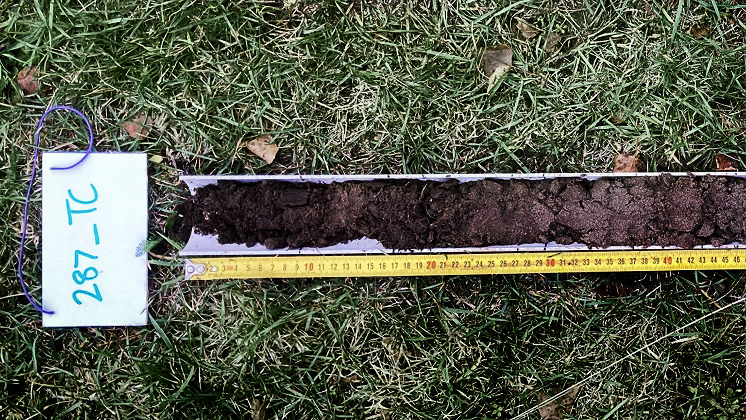
When we take soil horizon depth measurements, we measure from the top down. Measurements are in centimetres. For instance, in the image above, the O horizon would have the top at 0cm (0”) and the bottom at 5cm (2”). The A horizon would have its top at 5cm and its bottom at 30cm (12”) and so on.
The Soil Map Viewer we looked at above showed the soil classification across almost all of Aotearoa, but this has been generalised from a range of different data sets. In other words, it is based on the findings of a few thousand real-world test locations, and remote sensing using satellite images and laser scans.
It’s fairly accurate, as long as the soil in the real world hasn’t been worked and amended since the data was gathered (we’ll come back to this later). But it doesn’t tell us the full story of the soil in a particular location.
However, Manaaki Whenua does maintain a database of “point data” from 1,500 test locations around Aotearoa going back over 60 years. These contain much more in-depth information including physical (texture and structure) and chemical analysis of the soil horizons present.
This database is called the National Soil Data Repository (NSDR).
Activity — Using the National Soil Data Repository
Instructions to use the NSDR:
- Click here and then click the ‘Get Started’ button.
- Click the ‘Start Here’ button.
- Move and zoom the map until it shows a small number of records in the table below.
- Click on a record in the table below the map to view the data collected at that location.
- Use the NSDR Viewer to find a test location near you. Look through the information gathered during the test.
![[ADD IMAGE'S ALT TEXT]](/sites/default/files/NSDR%20screenshot.png)
So why is this information important?
Well, if you’re considering buying land to use for horticulture it may be a good idea to get a sense of the types of soils that have formed in the area. If you’re lucky there may be a test location from the NSDR nearby to give more detailed information.
If you’re serious about buying land for growing, we highly recommend you take soil tests, but these online sources are a good place to start.
Natural and amended soil profiles
It should also be noted that it is far easier to amend soil (the root zone) of shallow-rooted crops, such as vegetables than deep-rooted crops like fruit trees.
In other words, for an orchard, you’d want to make sure that the soil profile is correct before buying. For a market garden, community garden, or home vegetable garden, you can amend the root zone more easily or build raised beds.